ADVERTISEMENT

GPS Data+
Tools
![]() 4.5
4.5![]() 5K+
5K+
Editor's Review
GPS Data+ - essential application for all GPS users.
Presentation of all GPS data from device
Position, satellites, gps signal strength
Gps diagnose and gps testing
Splendid user interface: 3 newest color themes
Copy, share or show your position on the map easily
No ads!
With GPS Data+ you can check signal quality, test gps module, check your position/location, satellites count, fix time and much more!
Now UTM, MGRS and ECEF positioning system are available!
The nicest GPS test, status and diagnose app! If your gps navigation works horrible use this app to test, diagnose and fix your problem!
Five different tabs are at your service to check your GPS data+:
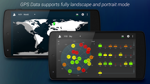
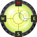
1) Sky tab + signal view – sky map view presents position of satellites connected with device on the sky. Each small circle represents one satellite with color adequate to signal strength and its status. Sky map circle is rotated depending on device compass. Signal strength view presents strength chart of satellites connected with device. Each bar represents one satellite, height of the bar is proportional to received signal strength.
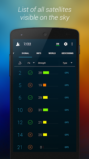
2) Signal tab – list of all satellites connected with device. Each row represents one satellite. With this list you get all details about satellite prn number, info about satellite fix, signal strength and type: GPS/GLONASS. Elevation and altitude is available in landscape mode.
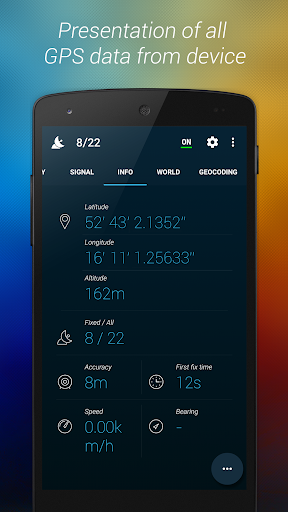
3) Info tab – on this tab all most important data are available, which is:
a.Position info – latitude, longitude, altitude
b.Signal info – accuracy, satellites fixed, first fix time (fft)
c.Movement info – speed, bearing
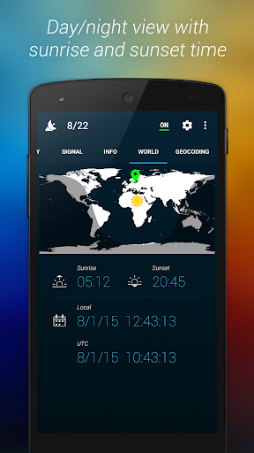
4) World tab – world map view presents position of the device, it also shows global sun position and day-light/night-dark area. There is local and UTC date time from GPS, also time of the sunrise and sunset are available.
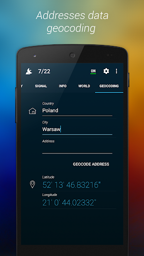
5) Geocoding tab - geocode address to world position!
Application offers different measurement units:
a)Speed: Metric – kmph, Imperial – mph, Nautical - knots
b)Distance: Metric – meters, Imperial - feet
c)Position units: seconds, minutes, degrees
GPS test and diagnose of your device. Management of A-GPS Xtra Data available:
a) Delete A-GPS Xtra Data
b) Download new A-GPS Xtra Data
ADVERTISEMENT
Screenshots