ADVERTISEMENT

Hawk Map Pro
Maps & Navigation
![]() 4.7
4.7![]() 500+
500+
Editor's Review
⭐⭐Pro Features⭐⭐
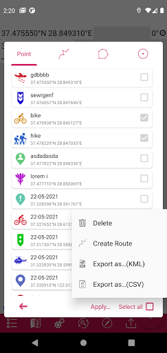
👉 List view for map markings.
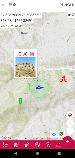
👉 Adding photos to map markings.
👉 Display an altitude graph for a drawn route.
👉 Location search by address.
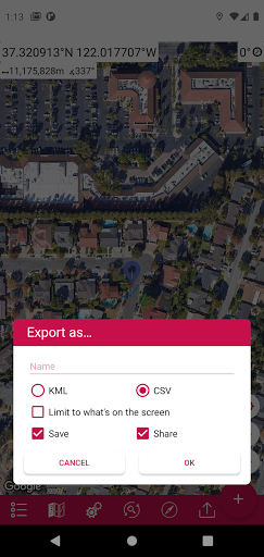
👉 Export the coordinates of the marked points in "CSV" format.
👉 More map options. (Topographic, cycling, etc.)
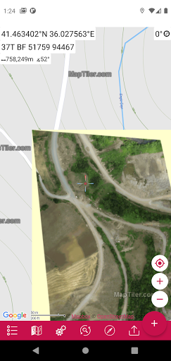
👉 Add custom map files in "mbtiles" format. (File content must be jpg or png, does not support vectors)
👉 Ability to add map url to be able to use maps of different map providers.
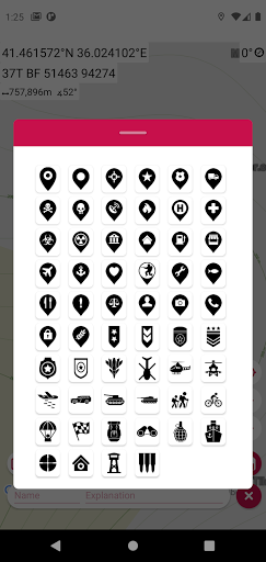
👉 More marker icons.
👉 Ad-free.
This app is a modern version of our "Mgrs & Utm Map" application.
GPS and coordinate systems helper especially for military personnel.
It is also a complete helper for airsoft, mountaineering, trekking and hiking, cross running, scouting, hunting, fishing, geocaching, off-road navigation and all other outdoor activities and sports.
With satellite navigation systems such as GPS, GALILEO and GLONASS (GNSS) supported by your device and your sensors, you can see your most accurate position on different map layers.
⭐⭐Features⭐⭐
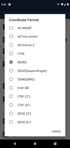
👉 Coordinate Indicator, finder and converter
Format options:
- D°M'S" (WGS84)
- Latitude/Longitude (WGS84)
- UTM (WGS84/NAD83),
- MGRS / U.S. National Grid (USNG) (WGS84/NAD83)
- SK42(Gauss Kruger)
- British National Grid(BNG-OSNG)
- Irish Grid Reference
- ED50 (6°-3°)
- ITRF (6°-3°)
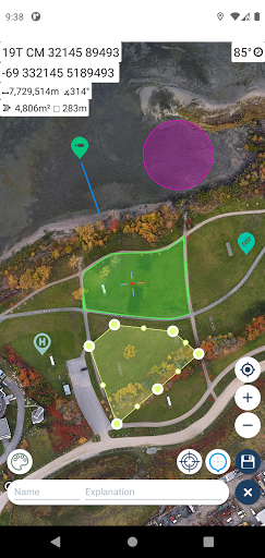
👉 You can make colored markings on the map.
Markers,Polygons,Polylines,Circles
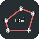
👉 Area & Distance measurement
Distance unit options: m , ft , mi , yd , nmi
Area unit options: m² , ha , ft², yd², mi²
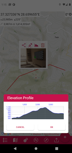
👉 Elevation information
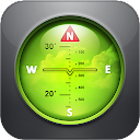
👉 Compass
Angular unit options: Degrees ,NATO mil, Warsaw Mil, Grad
👉 Map style options: (Road,Terrain,Satellite,Night Mode,Hybrid)
👉 KML viewer. (Export and import KML layers).
👉 GPS track recorder.
ADVERTISEMENT
Screenshots