ADVERTISEMENT
i-Boating:UK/Ireland:Marine
Maps & Navigation
![]() 100+
100+
Editor's Review
This App offers access to marine vector covering UK/Ireland waters (derived from UKHO data). First marine GPS app to have route assistance with Voice Prompts for marine navigation. You can create new boating routes or import existing GPX/KML routes. It supports Nautical Charts course up orientation. Includes Tide & Currents prediction.
►FEATURES
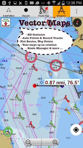
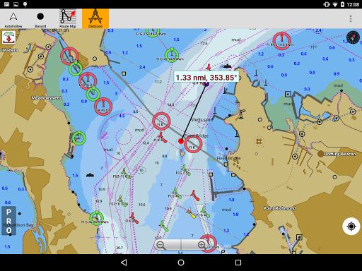
√ Beautiful and detailed Hardware/GPU accelerated vector charts (text stays upright on rotation)
√ Long press to query the details of Marine object (Buoy, Lights, Obstruction etc).
√ Customizable depth(Ft/Fathom/Meter) and distance units (km/mi/NM)
√ Customizable Shallow Depth.
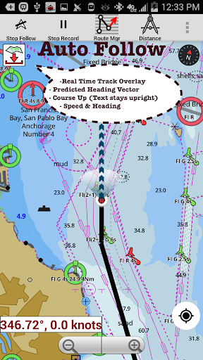
√ Record tracks, Autofollow with real-time track overlay & predicted path vector.
√ Voice Prompts for marine navigation (requires GPS )
√ 1ft / 3ft depth contour maps for anglers for selected lake maps.
√ Supports GPX/KML for boating route editing/import.
√ Tide & Currents prediction.
√ Seamless chart quilting of marine charts
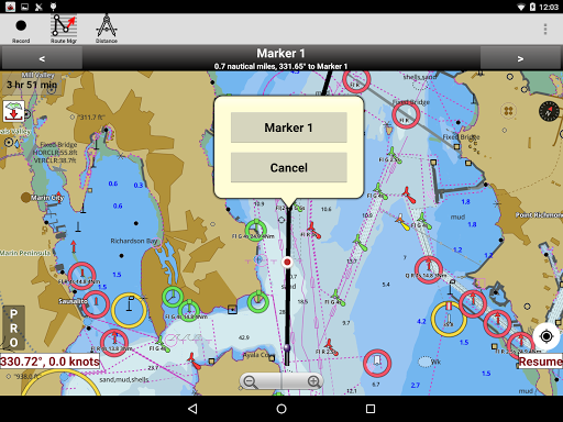
√ Enter or import Waypoints.
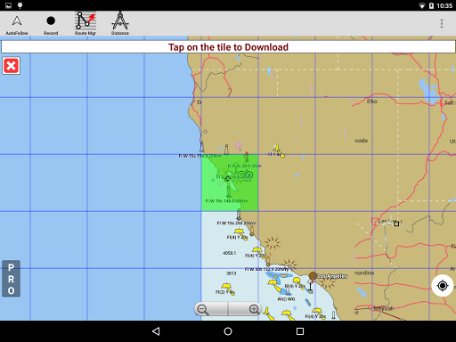
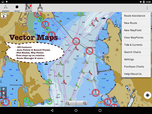
► MAPS
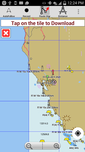
The maps include coverage of coast of UK & Ireland (derived from UKHO data).
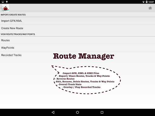
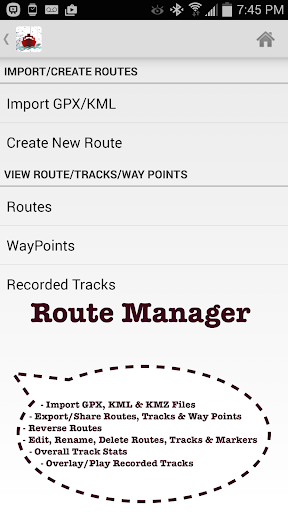
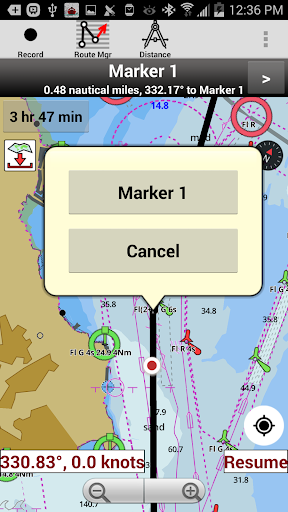
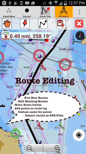
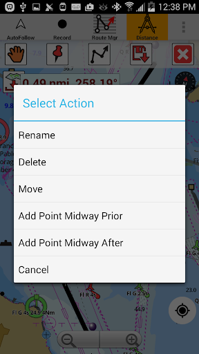
►ROUTE MANAGEMENT / TRIP PLANNING
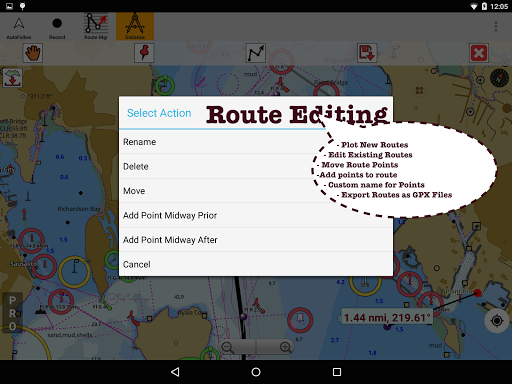
√ Create New Route/Edit Existing Routes
√ Move Points
√ Add points to an existing route leg
√ Delete / Rename points
√ Import GPX, KML & KMZ files
√ Plot/Edit Routes
√ Enter Waypoints
√ Share/Export Routes, Tracks & Markers
√ Reverse Routes
►GPS FEATURES
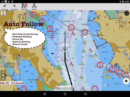
√ Auto Follow
* Real Time Track Overlay
* Predicted Path Vector
* Course Up (Text stays upright)
* Speed & Heading
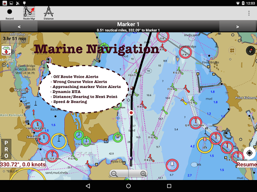
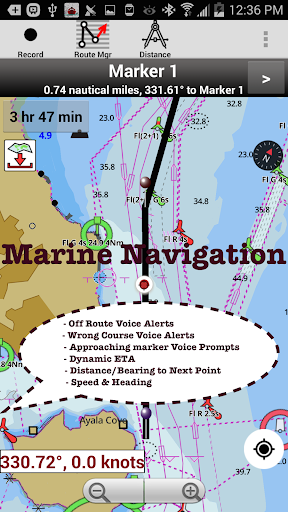
√ Route Assistance With Voice Prompts
* Prompts when approaching a boating route marker
* Continous distance and ETA updates
* Alerts when sailing/boating off route
* Alerts when boating in wrong direction
√ Record Tracks
►NMEA Instrumentats
√ AIS & GPS(NMEA over TCP/UDP)
√ Wind direction & Speed,Sonar depth,Water temperature
► Available Chart folios
√ BRISTOL CHANNEL & SOUTH IRELAND
√ ENGLAND S COAST & SCILLIES
√ IRELAND W C-KENMARE R-FORELAND
√ IRISH SEA
√ N&E SCOTLAND-LEWIS-FORTH-N ISLES
√ NORTH SEA-FORTH-THAMES ENTRANCE
√ SCOTLAND KINTYRE-LOCH BROOM
√ THAMES-MEDWAY & APPROACHES
►TIDE & CURRENTS
* For US, Canada, UK, Germany & New Zealand
* High/Low Tides
* Tidal Current Prediction
* Active Current Stations
► SHARING
* Share tracks/routes/markers on Facebook & Twitter
* Export tracks/routes/markers as compressed GPX files.
►Custom Base Map
√ Satellite/Aerial Imagery, Street Maps etc.
►Online Chart Viewer
http://fishing-app.gpsnauticalcharts.com/i-boating-fishing-web-app/fishing-marine-charts-navigation.html#12.21/51.4638/0.4629
ADVERTISEMENT
Screenshots