ADVERTISEMENT

ShipAtlas by Maritime Optima
Productivity
![]() 4.6
4.6![]() 50K+
50K+
Editor's Review
The one and only application for individuals and consumers interested in following ships.
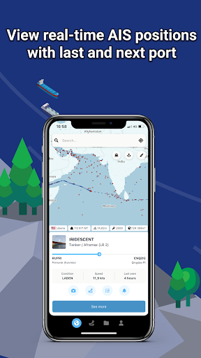
Download now and get the real-time AIS position of vessels with processed AIS data from more than 700 satellites and terrestrial senders.
ShipAtlas is a FREEMIUM app for everyone interested in AIS vessel tracking and trades, port activities, congestions, sea routes, marine weather, ice conditions, piracy zones and marine maps.
Every second we collect raw AIS data from more than 700 AIS satellites, terrestrial senders, and dynamic AIS sources. We spend time and knowledge in data wrangling, cleaning, and unifying messy and processing complex data sets to give you high quality data.
The vessels are divided into types (segments and sub-segments). Select and deselect vessel segments and sub-segments to get a quick overview of vessels within the segment you are interested in.
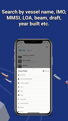
Search for vessels by vessel name, IMO or MMSI, or port names and type. Combine searches with more detailed info such as LOA, beam, draft and year built. Search for ports by port name, country or cargo type.
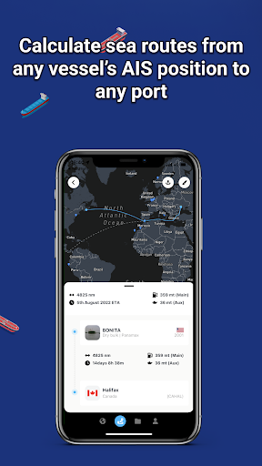
The quick and easy-to-use sea route calculator will give you the ETA, distance in nm, time at sea and estimated bunker consumption. Route from any vessel's real-time AIS position to any port, or between ports.
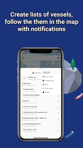
Create an unlimited number of vessel lists/fleet lists matching your search criteria and follow the vessels in real-time on the map.
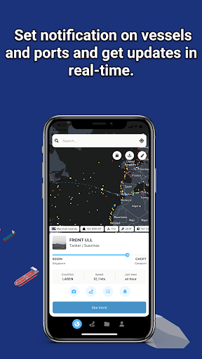
Set notifications on vessels and ports and get updates in real-time.
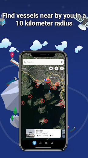
Turn on your location and find all the vessels nearby you, in a radius of 10 km.
Get the historical AIS data for all vessels, listed or shown as vessel tracks in the map.
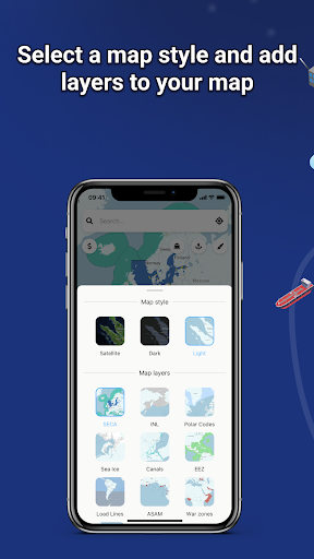
Access daily updated marine information: port activities, tides, local time, congestion, marine weather, ice conditions, and piracy. Add layers on your map: economic zones, Polar Codes, ECA/SECA zones, Load Lines, INL, etc.
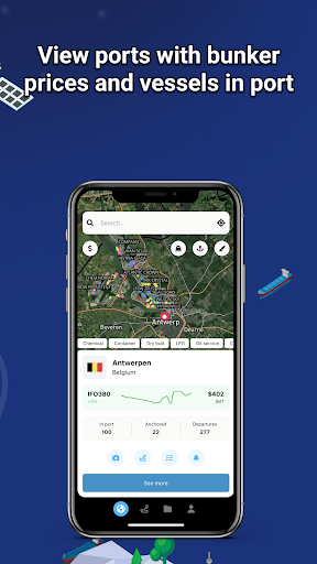
Find canals restrictions, view vessels waiting at anchorage, study the activity of the ports, and quickly find real-time bunker prices and availability in more than 5 200 ports.
Use the same login on your mobile as on your laptop/desktop. Your data is automatically synced on all your devices.
A dedicated support chat is integrated in the app and we are happy to assist you at any time.
The data quality, the easy-to-use interface and design, the sea distance calculator (routing from a vessel's AIS position to any port) and the price makes ShipAtlas one of the best vessel tracking apps there is.
Most features are free but you can upgrade to a paid subscription inside the app and access more features. In-app purchases from €10 per month (on web).
We hope you'll give ShipAtlas by Maritime Optima a try!
Visit our website to learn more:
https://maritimeoptima.com/shipatlas
ADVERTISEMENT
Screenshots