ADVERTISEMENT

SmartRide
Maps & Navigation
![]() 4.6
4.6![]() 100K+
100K+
Editor's Review
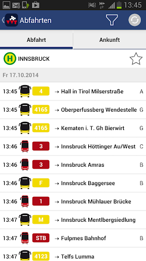
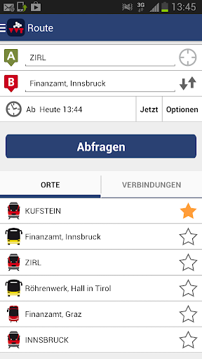
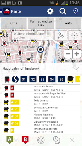
SmartRide, the all-rounder for mobile travel information from the VVT (Verkehrsverbund Tirol), has been optimised! Information services from VVT SmartRide previously only available in Tyrol are now available throughout Austria! All timetable information, whether for bus, train, tram, bike or footpaths, is now available from a single app for the entirety of Austria. Find the best connection thanks to an Austria-wide, multimodal travel information service including Bike & Ride, Park & Ride and car-train combinations.
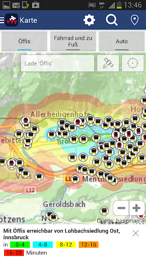
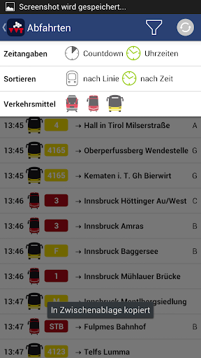
VVT SmartRide works by simply inputting an address and utilises the most current data. Current traffic conditions, construction sites, traffic jams, or late arrivals of buses or trains can all be accounted for. The user doesn’t even have to know exact stops names! Thanks to GPS activation, the closest stops can be selected based on current device location. Optionally, points of interest or street names can be entered. SmartRide makes quick, uncomplicated information available so that you can easily compare various means of transportation. Clear mapping for orientation is provided and has been improved with a new design. New features also include the ability to send traffic info via email or text message or the possibility to save departure and arrival times in the calendar.
Overview of VVT SmartRide features:
- Find the right stop via GPS – all stops and connections are displayed
- Travel suggestions including time required and costs
- Send connections via email or text message
- Save connections to a calendar with reminders
- Clear map presentation
- Define favourites
- Compare modes of transportation including public transport, walking, biking and car routes with respective travel times as well as CO2 emissions
ADVERTISEMENT
Screenshots