ADVERTISEMENT
Nautical Maps: Boat Navigation
Maps & Navigation
![]() 3.5
3.5![]() 100K+
100K+
Editor's Review
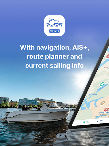
The most comprehensive app for safe and prepared boating navigation. With route planner, water maps, AIS +, marina’s, bridges and locks, offline use and more. Try now and plan your next trip!
With the Nautical Maps (formerly ANWB Nautical Maps) app you have everything you need at hand:
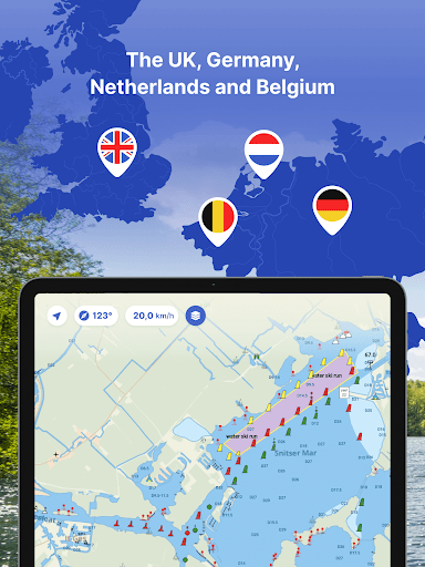
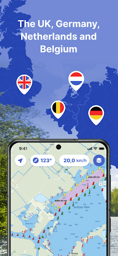
• 4 countries, 1 price: Complete nautical maps of the United Kingdom, Netherlands, Germany and Belgium
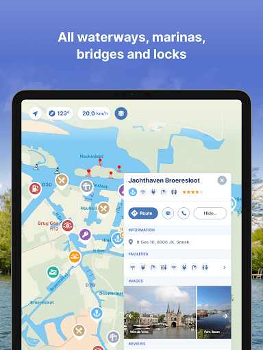
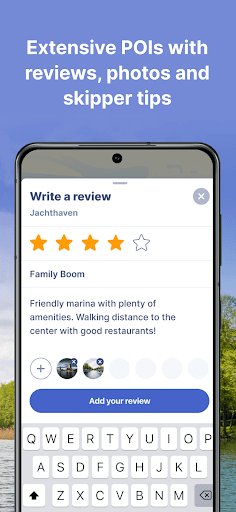
• All almanack info: Access all information you need on the water with just a few taps in the app
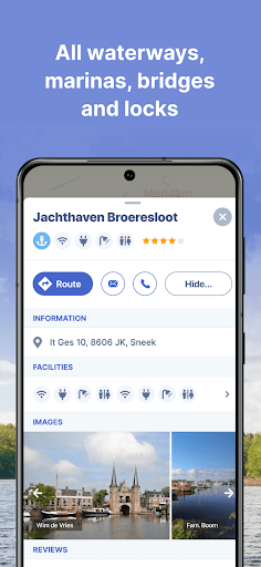
• All current information about marinas, bridges and locks including opening times
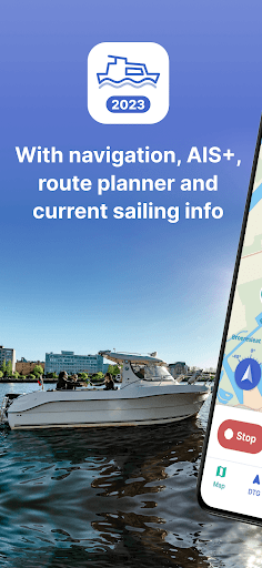
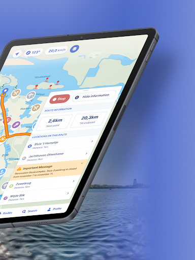
• Plan the optimal route between your starting point and destination, including the objects you encounter (beta 2.0)
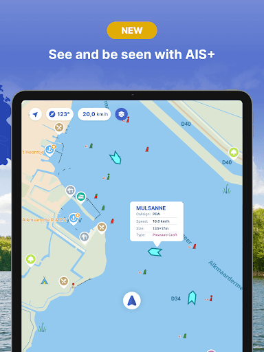
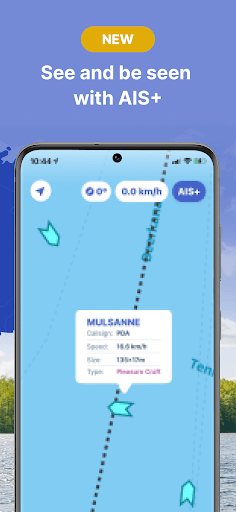
• New! AIS +: Share your position in real time and see at a glance where surrounding ships are located (currently only available for the Netherlands)
• Show or hide information on the nautical maps to see exactly what you need
• Stay up-to-date with the current navigation reports and obstructions from the Rijkswaterstaat
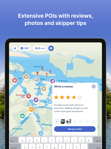
• More than 200,000 nautical objects (bridges, locks, markings, mooring places and more)
• Locations of more than 4,000 marinas and all details of existing facilities
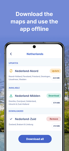
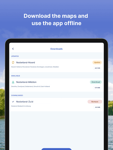
• Radio silence on the water? No problem! Download the corresponding charts for offline use
• Regular updates and free access to all new features
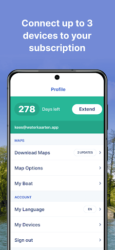
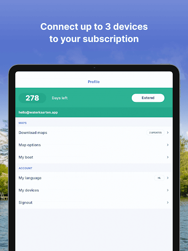
• Each user account can be used on up to 3 devices at no extra cost
• Free Windows version included with the subscription
• Reliable service: We are at your service 7 days a week ([email protected])
• With information based on the ANWB Nautical Maps of 2018
How the subscription works:
Nautical Maps is free for the first 7 days. After that, the app only works with a valid subscription. You can purchase the following subscriptions:
• Monthly subscription (€ 13,99)
• Seasonal subscription (3 months for just € 31,99)
• Annual subscription (€ 44,99)
The subscription ends automatically.
Please note: If you purchase a subscription during the free 7-day trial period, we will add your new credit to your remaining balance. Your purchased subscription is not automatically renewed.
Payment methods for subscription:
• The subscription will be charged to your Google account
• At Google you can use different payment methods for a subscription, such as PayPal or credit card
Even more boating pleasure with a Nautical Maps account
You can create an account in the app to activate your subscription on a total of 3 devices.
Note:
• The file size of the offline map material is very large and you are advised to download it on a stable Wi-Fi connection
• Prolonged use of GPS in the background can considerably shorten the battery life of your device
Do you have questions about the app? Please contact our helpdesk ([email protected]) or read more on our website (www.waterkaarten.app/en).
Please note that this app is only intended as an aid when navigating on the water. Stay alert to your surroundings while boating.
ADVERTISEMENT
Screenshots